EncDotNet.S100




Overview
EncDotNet.S100 is a managed, cross-platform implementation of the IHO S-100 Universal Hydrographic Data Model for .NET. In plain terms, it reads and draws electronic nautical charts and related marine data layers — depths, currents, water levels, navigational warnings, aids to navigation, and more — and it runs on macOS, Windows, and Linux. It provides:
- A set of reusable libraries for reading, portraying, rendering, and validating S-100 product data — from ISO 8211 ENC cells to HDF5 coverage grids to GML feature collections — behind a common pipeline abstraction.
- A cross-platform desktop viewer (Avalonia + Mapsui) that loads any combination of supported products from an exchange set or as loose files and renders them, time-aligned, on an interactive map.
- A standalone command-line tool (
s100) that renders any supported dataset to an image or a web-map tile set, validates and converts datasets, checks routes, predicts tides, and serves charts as XYZ tiles, WMTS and WMS to web maps and GIS desktops. It's self-contained, with no .NET install required, and also ships as theghcr.io/philliphoff/s100container image. - An MCP server that exposes datasets to AI agents — feature
discovery and query (
identify_features,nearest_features,count_features,describe_feature), coverage sampling, route checks and tide predictions. It runs inside the viewer, where it also plans routes and drives the view, or headless withs100 mcp serveover standard input and output or HTTP.
The goal is to make S-100 data approachable for .NET developers and end users without requiring native dependencies, commercial S-52 assets, or platform-specific tooling. Everything runs on macOS, Windows, and Linux.
Getting started
Just want to look at charts? Download the desktop viewer from the latest release — a pre-built, self-contained app for macOS, Windows, and Linux (no .NET install required) — and open a file or exchange set. The getting-started guide walks through it, and the viewer section below tours the features.
Building on top of the data? docs/getting-started.md
walks you from zero to a rendered PNG with either the EncDotNet.S100
library facade or the standalone s100 command-line tool.
Serving charts to a web map or GIS? Point s100 tiles serve at a folder
of charts, or run it in Docker; see
Serve charts to a web map or GIS and
Run s100 in Docker.
using EncDotNet.S100;

using var dataset = S100Dataset.Open("chart.000");   // detects the spec
using var renderer = new PngS100DatasetRenderer();
byte[] png = await renderer.RenderAsync(dataset);     // bundled FC + PC
File.WriteAllBytes("out.png", png);
The runnable
samples/EncDotNet.S100.Samples.Quickstart
console project demonstrates this end-to-end against a bundled synthetic
fixture — dotnet run it with no setup. The
samples/EncDotNet.S100.Samples.RouteCheck
checks a passage against synthetic charts, depths, water levels, areas and
warnings with RouteChecker.
Supported standards
Every supported product ships a reader and a portrayal pipeline, and every product with a ✅ below ships a normative validation rule pack.
| Standard | Subject | Encoding | Portrayal | Validation pack |
|---|---|---|---|---|
| S-101 | Electronic Navigational Charts | ISO 8211 | Lua (Part 9A) | ✅ |
| S-102 | Bathymetric Surfaces | HDF5 | Coverage (Lua) | ✅ |
| S-104 | Water Level Information | HDF5 | Coverage | ✅ |
| S-111 | Surface Currents | HDF5 | Arrow symbology | ✅ |
| S-122 | Marine Protected Areas | GML | XSLT | ✅ |
| S-124 | Navigational Warnings | GML | XSLT | ✅ |
| S-125 | Marine Aids to Navigation | GML | XSLT | ✅ |
| S-127 | Marine Resources & Services | GML | XSLT | ✅ |
| S-128 | Catalogue of Nautical Products | GML | XSLT | ✅ |
| S-129 | Under Keel Clearance Management | GML | XSLT | ✅ |
| S-131 | Marine Harbour Infrastructure | GML | Lua (Part 9A) | ✅ |
| S-201 | Aids to Navigation Information (IALA) | GML | XSLT | ✅ |
| S-411 | Sea Ice Information | GML | XSLT | ✅ |
| S-412 (draft) | Marine Weather Warnings | GML | XSLT | ✅ |
| S-421 | Route Plans | GML | XSLT | ✅ |
| S-401 (IEHG) | Inland ENC | ISO 8211 | Lua (Part 9A) | — |
| S-57 (legacy) | Electronic Navigational Charts (Ed 3.1) | ISO 8211 | via S-101 pipeline | ✅ (delegated) |
S-401 (IEHG inland ENC) shares the S-100 Part 10a ISO 8211 encoding and
the Part 9A Lua portrayal model with S-101, so it is read and portrayed
through the S-101 pipeline with the bundled IEHG Feature and Portrayal
Catalogues (see EncDotNet.S100.Specifications/content/S401/README.md
for their provenance). S-401 cells are told apart from S-101 and S-57
cells by the product identifier each declares in its ISO 8211 DSID
record. Edition 1.3.0 of the S-401 Portrayal Catalogue is still a draft
and no validation rule pack ships yet.
S-57 cells are translated to the in-memory S-101 model and rendered
through the S-101 portrayal pipeline — or, for an inland ENC (a cell
declaring DSID/PRSP = 10), through the same pipeline with the S-401
catalogues; validation runs as two passes
with S-101 findings rebadged S101-as-S57/* so the user can tell
which layer of the pipeline a finding came from. This is a
best-effort path for viewing legacy chart collections; it is not
an S-52 implementation.
The Viewer
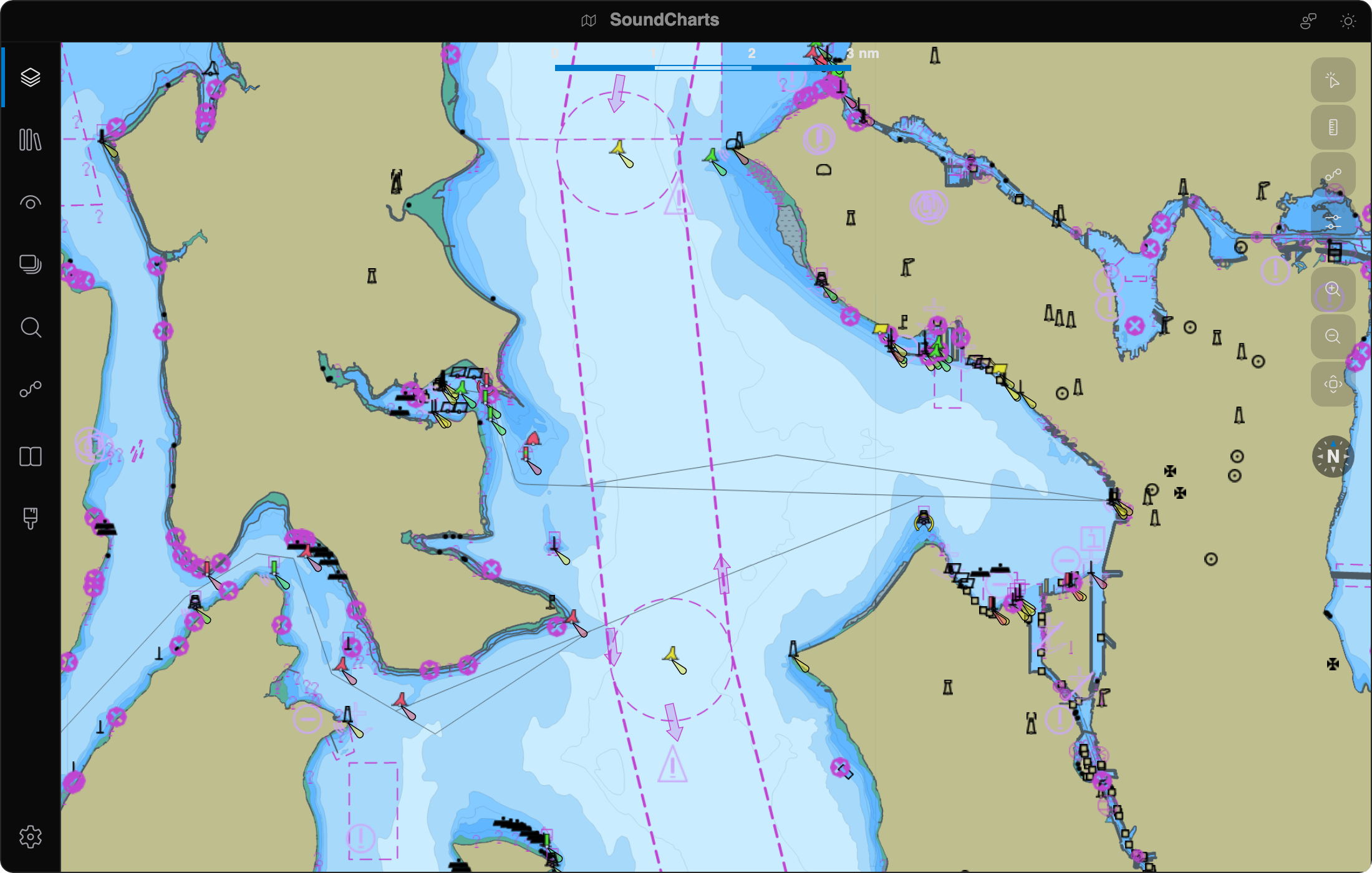
SoundCharts: S-100 Viewer (project EncDotNet.S100.Viewer; website soundcharts.app) is a
cross-platform desktop nautical chart viewer built on Avalonia and
Mapsui. It loads any combination of the
supported products and renders them time-aligned over a bundled
offline basemap (Natural Earth land; OpenStreetMap optional). Headline features:
- Multi-product paint stack driven by the S-98 interoperability authority (display planes, within-plane priority, inter-product rules) rather than load order.
- Activity-bar panels for the Library, Datasets, Layer Stack, ECDIS Display Controls, Object Information (pick reports) and Legend, Routes, Vessels (AIS targets + own-ship), Validation, Logs and Settings — every panel can be docked, hidden, or rearranged, and the layout persists between sessions.
- Library of chart collections — local folders, exchange sets, online catalogues (NOAA, USACE inland ENC, community lists, S-100 feeds) and SECOM services — browsed, filtered and downloaded without loading every dataset.
- Interactive route planning — build editable, persistent routes aligned to the in-repo S-421 route model: a numbered waypoint / leg timeline with per-leg great-circle or rhumb-line geometry and live distance and bearing, drawn and edited directly on the map (and drivable by an AI agent through the MCP route tools). Routes import and export as RTZ and S-421.
- Route checks against everything loaded — charted dangers, S-102 depths, S-104 or predicted tide for under-keel clearance at each leg's ETA, regulated areas, navigational warnings and weather — with a findings list and a clearance profile.
- Tide and current predictions at NOAA stations, offline, on the map and the Timeline, and to adjust charted depths where no S-104 covers the area.
- Weather overlays (not for navigation) from GRIB2 and NetCDF forecasts, CAP and S-412 warnings, NHC tropical cyclone advisories, WPC surface analyses, NDBC buoys and own-ship NMEA instruments.
- Measure and range & bearing tools, S-102 relief shading, and predefined display combinations.
- Pick / Object Information for both vector and coverage
products, with FC-decoded attribute names, follow-the-
xlinkreference navigation, and an embedded time-series chart for fixed-station S-104 / S-111 observations. - ECDIS-style controls — display category, display planes, text groups, per-spec viewing groups, Day / Dusk / Night palettes, and mariner settings (safety contour, depth contours, four shades, simplified symbols, radar overlay).
- Global timeline for time-varying datasets (S-104, S-111, S-411, weather) and tide predictions.
- Validation panel with click-to-zoom, severity colouring, and an overlay marker layer.
- In-app feedback and crash recovery — a Report Feedback flow that bundles diagnostics into a pre-filled GitHub issue, plus next-startup detection and reporting of unclean shutdowns.
- Live overlays through the dynamic-feature-source abstraction — an own-ship glyph with true-scale hull + arrowhead + CCRP cross at zoom, plus an AIS-target overlay backed by the aisstream.io WebSocket service and rendered with a per-class palette using the same hull/arrowhead vocabulary.
- Optional MCP server (off by default) exposing the loaded datasets to AI agents.
- NATO Additional Military Layers (AML) cells, drawn with SoundCharts' own portrayal on their own display plane.
See the viewer README for the full feature guide, and the per-product gallery below for what each product looks like in the viewer.
Gallery
The gallery images are the soundcharts.app captures,
made by site/capture/capture.cs from public NOAA and
USACE data and the repo's test fixtures; manifest.json
records the datasets and viewer calls behind each one.
| Product | Screenshot |
|---|---|
| S-101 ENC | 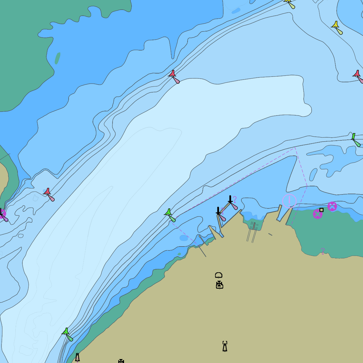 Quebec City harbour, from the Canadian Hydrographic Service's S-100 sample data.1 |
| S-57 (via S-101) | 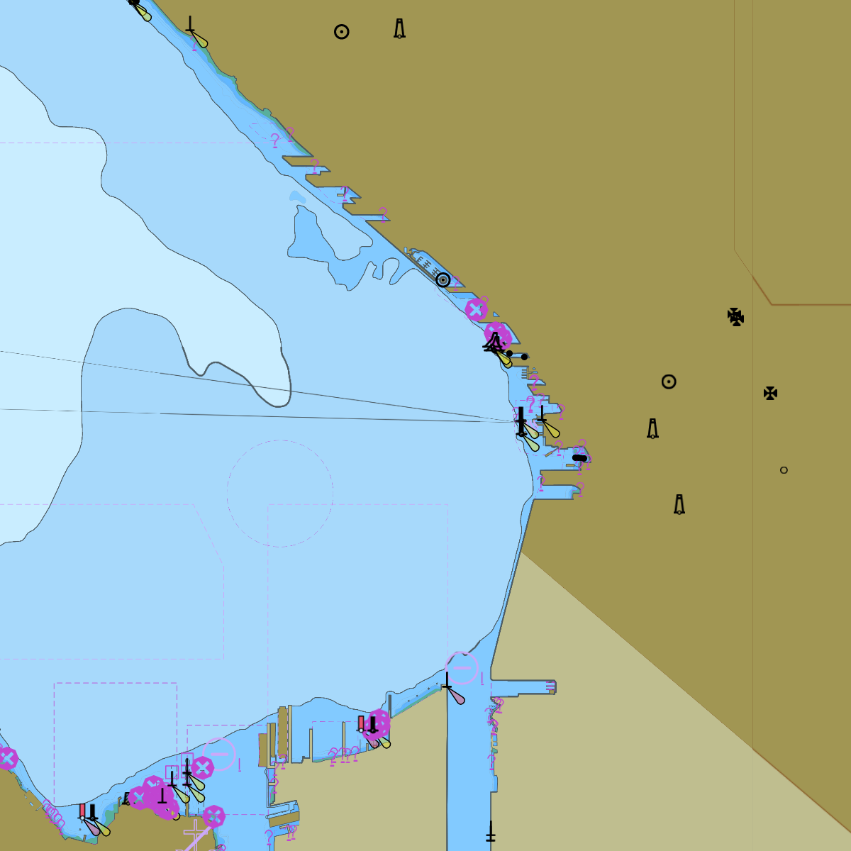 NOAA ENC, Elliott Bay, Seattle. |
| S-57 Inland ENC | 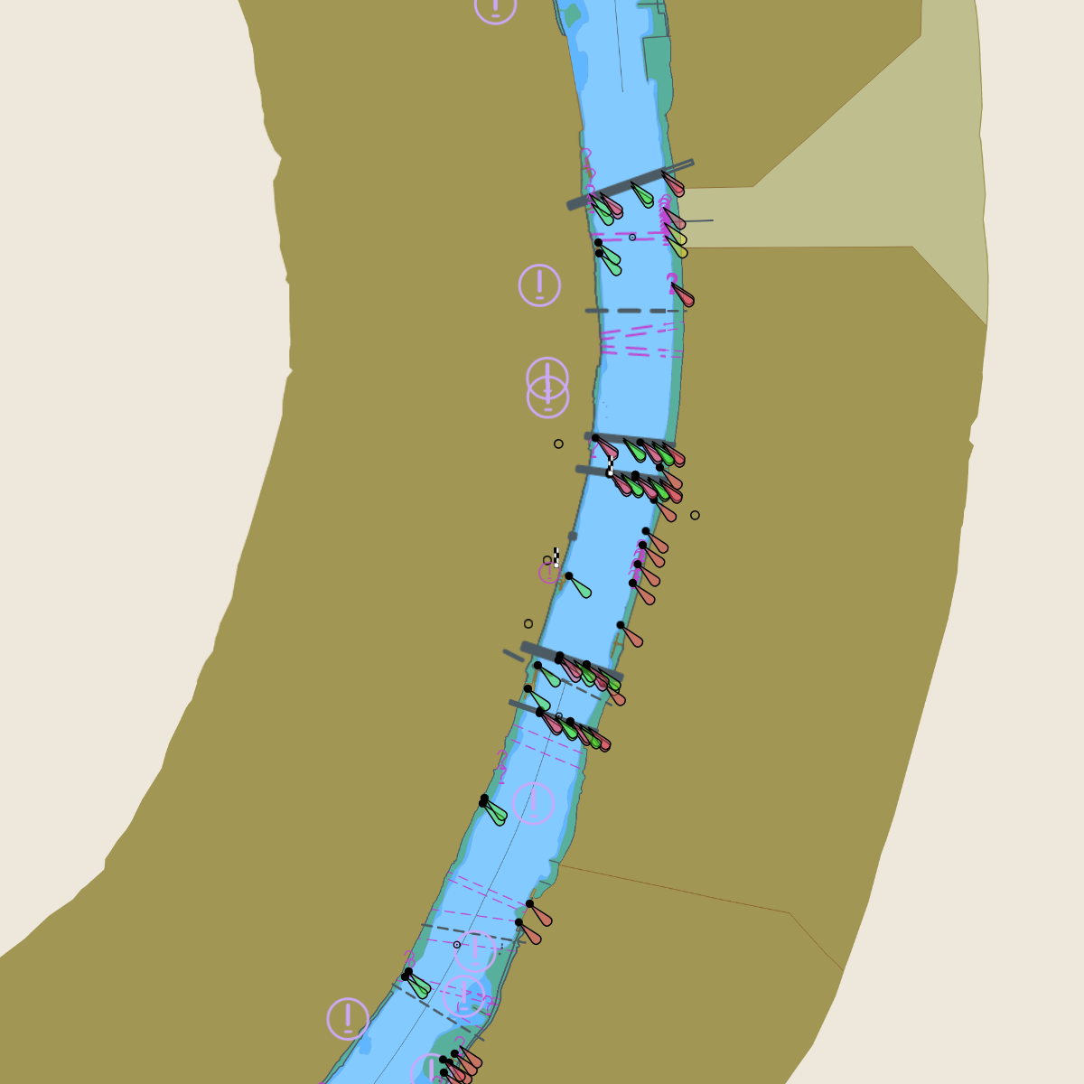 USACE inland ENC, Mississippi and Missouri at St. Louis. |
| S-102 Bathymetry | 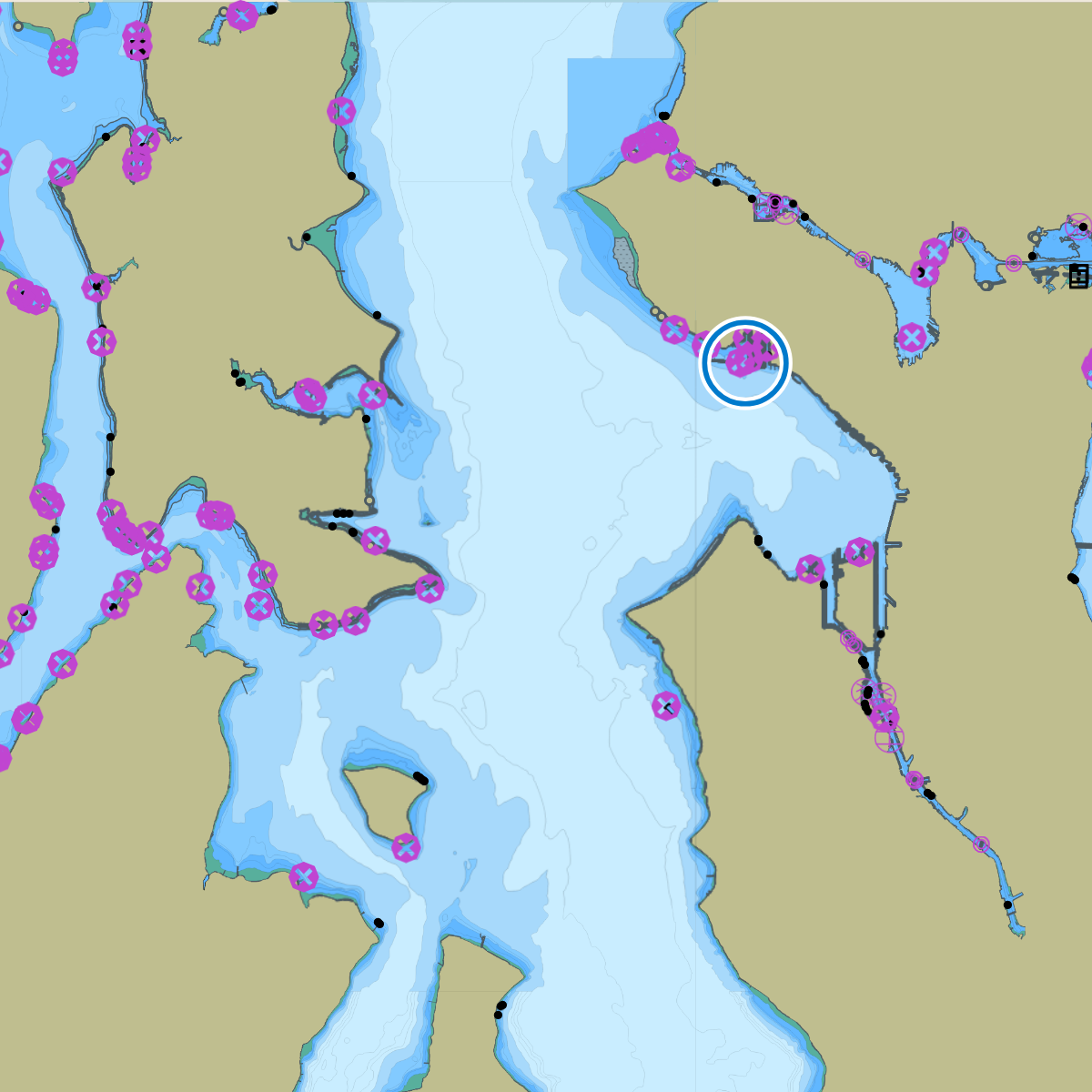 NOAA S-102 over the NOAA ENC, four-shade depth zones. |
| S-104 Water Level | 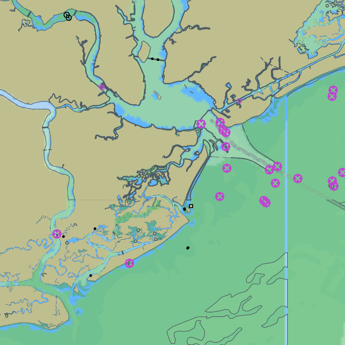 NOAA S-104 water-level pilot, Charleston (repo fixture). |
| S-111 Surface Currents | 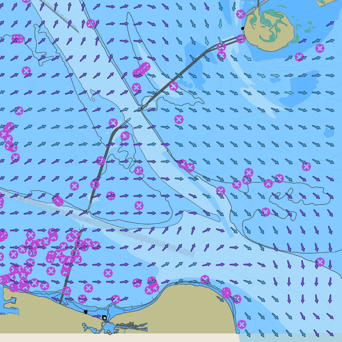 NOAA CBOFS S-111 forecast, Chesapeake Bay entrance. |
| S-122 Marine Protected Areas | 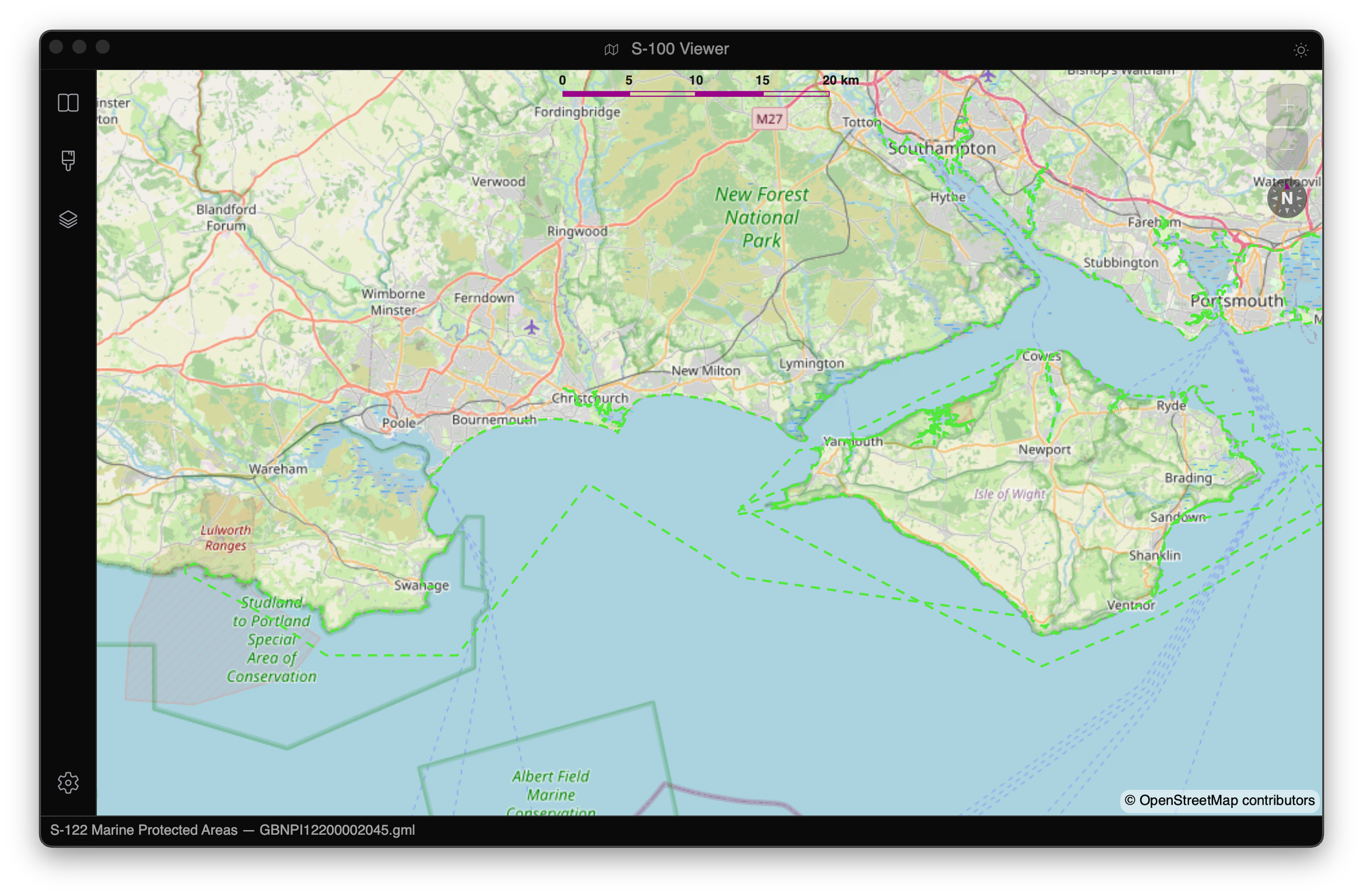 |
| S-124 Navigational Warnings | 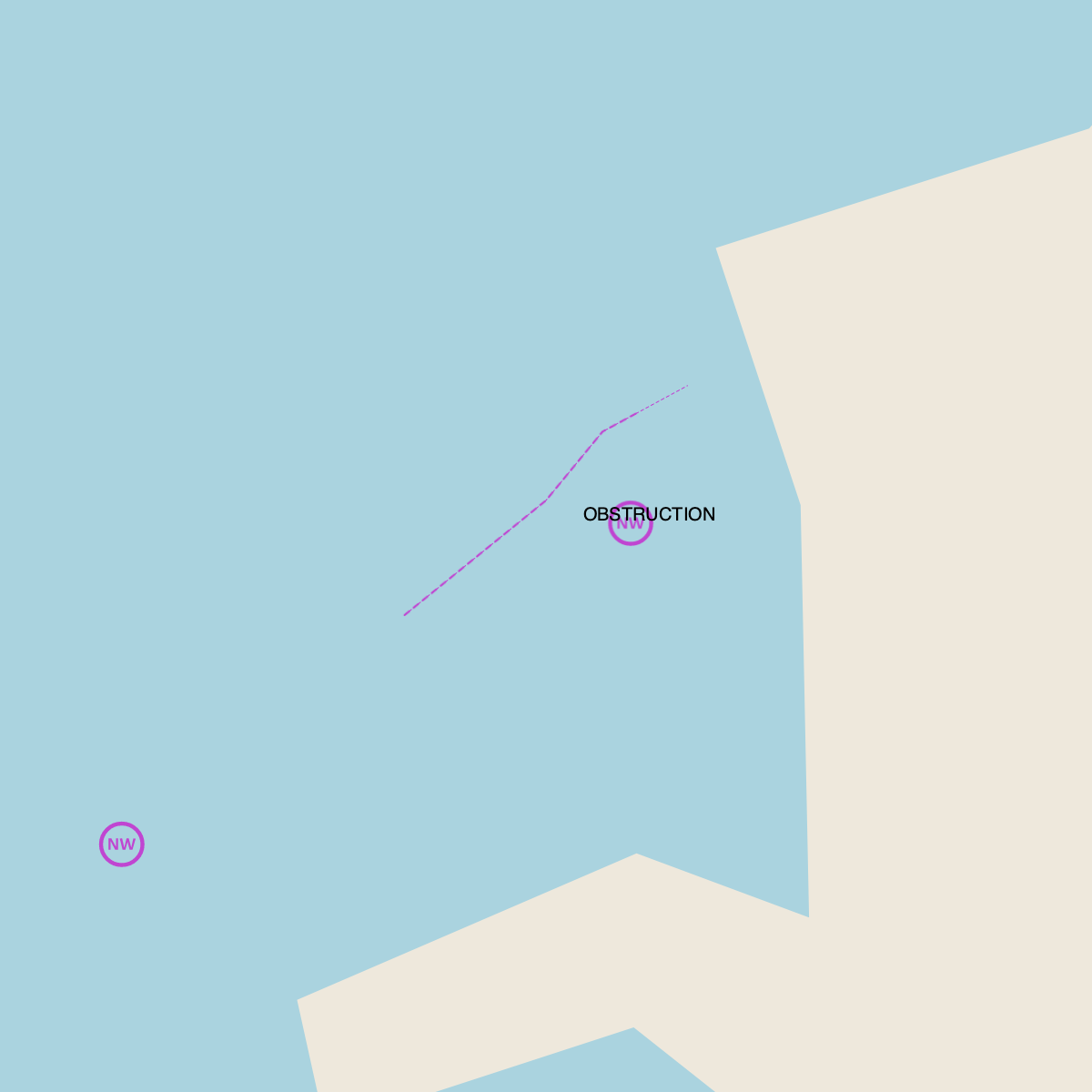 Synthetic warnings (repo fixture). |
| S-125 Marine AtoN | 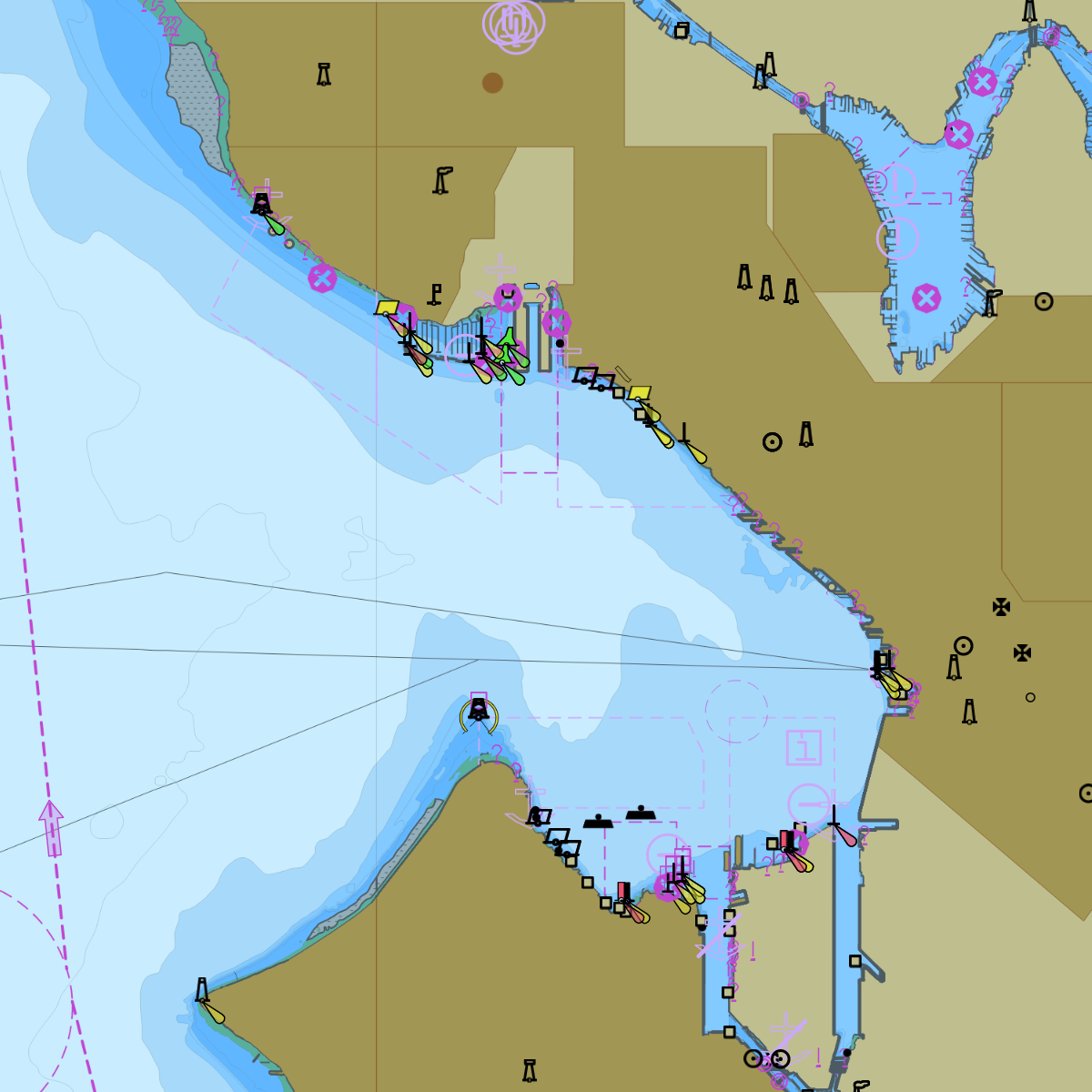 S-125 derived from NOAA ENC aids to navigation, Elliott Bay. |
| S-127 Marine Services | 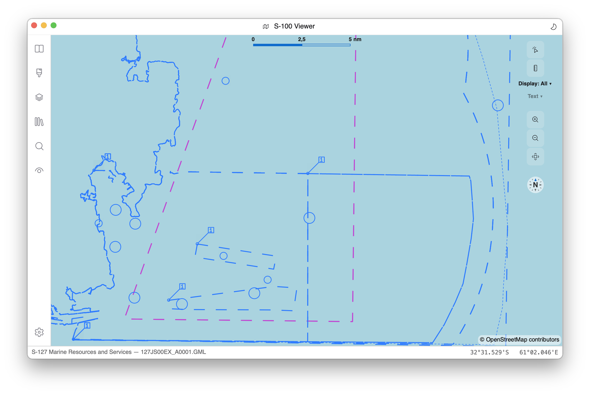 |
| S-128 Catalogue | 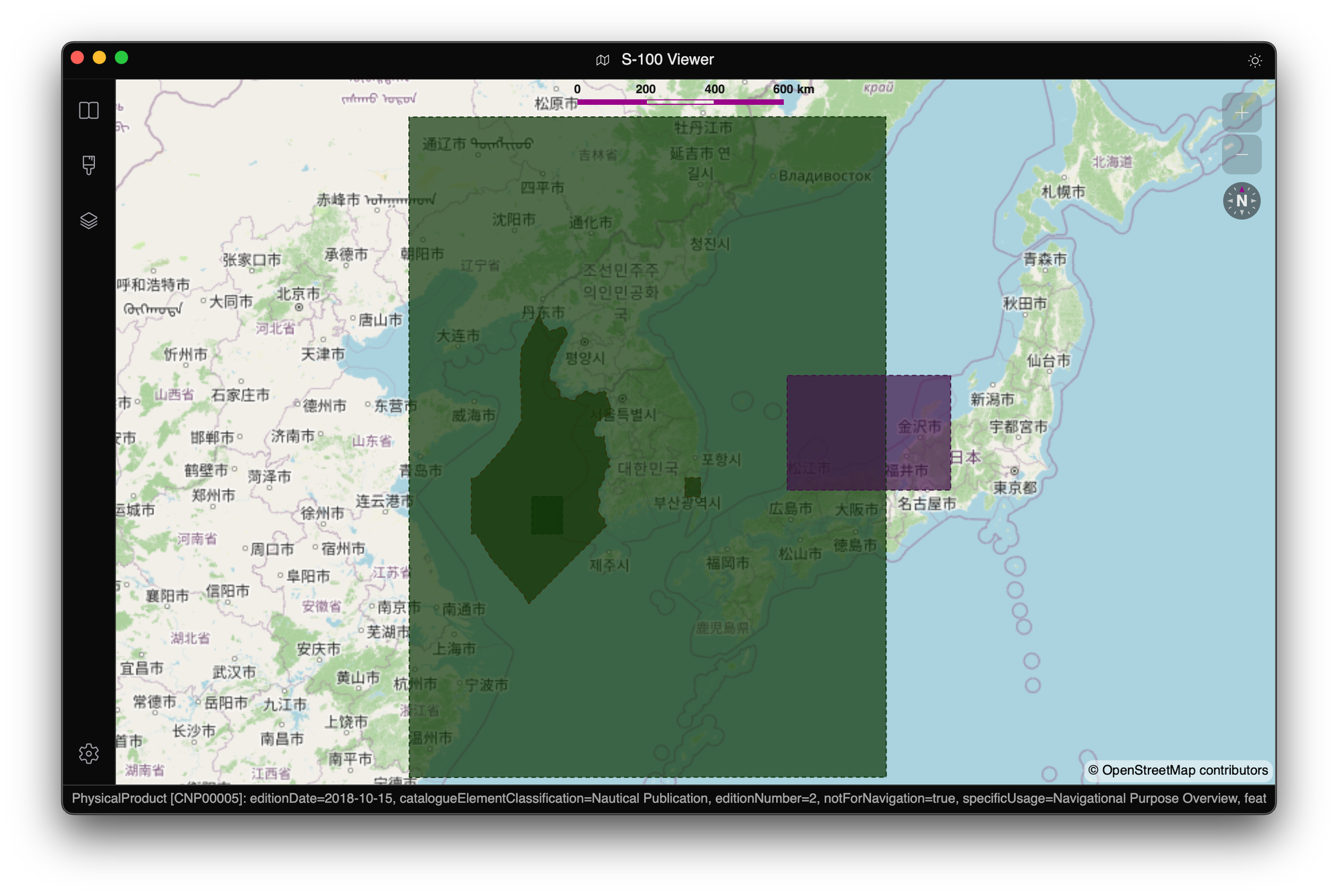 |
| S-129 UKC | 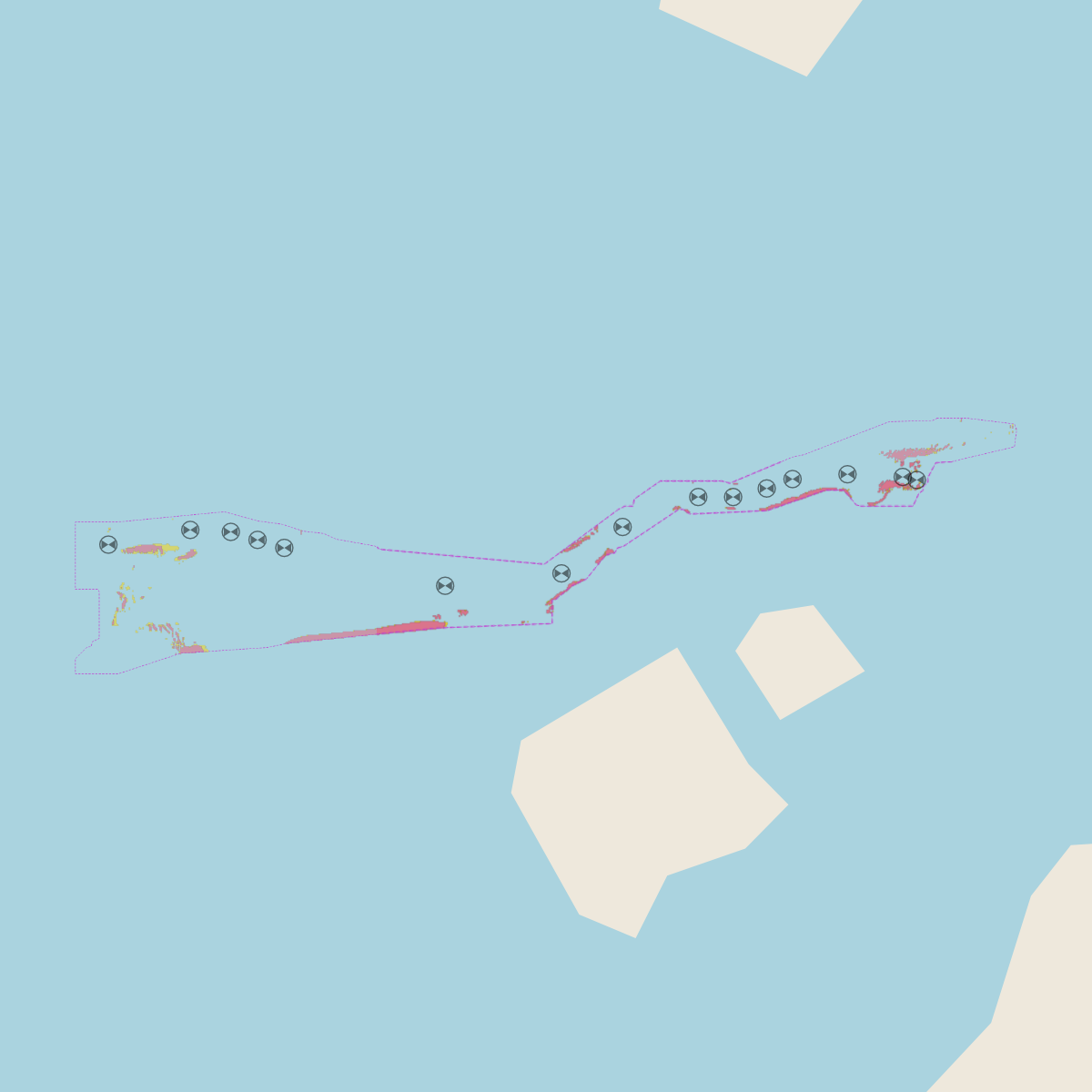 UKC plan, Torres Strait (repo fixture). |
| S-131 Marine Harbour | 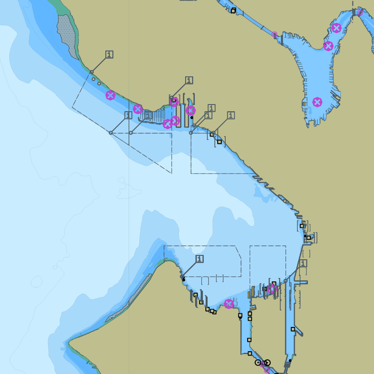 S-131 derived from NOAA ENC harbour features, Elliott Bay. |
| S-411 Sea Ice | 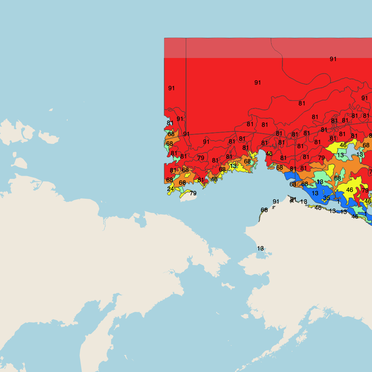 US National Weather Service ice analysis, Alaska. |
| S-421 Route Plan | 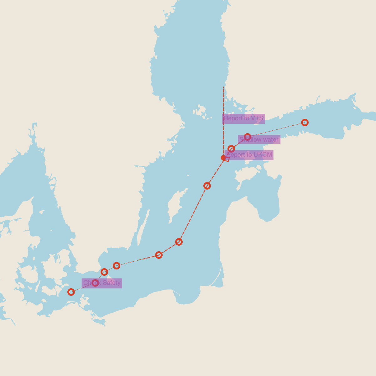 Route plan, Baltic (repo fixture). |
1 The S-101 chart of Quebec City was made by the EncDotNet.S100 project and contains intellectual property of the Canadian Hydrographic Service (CHS) of the Department of Fisheries and Oceans. This product does not meet the requirements of the Navigation Safety Regulations, 2020 under the Canada Shipping Act, 2001. Charts and publications issued by or on the authority of CHS must be used to meet the requirements of those regulations. The copyright in the data are and remain the property of His Majesty the King in Right of Canada and shall not be sold, licensed, leased, assigned or given to a third party. The incorporation of CHS data in this product does not constitute an endorsement or an approval of this product by the Canadian Hydrographic Service, the Department of Fisheries and Oceans or His Majesty the King in Right of Canada.
Command-line tool
s100 is a cross-platform console tool that drives the same portrayal
and validation pipelines as the viewer through a headless Skia
renderer, with no UI. It renders any supported product to an image or a
tile set, validates datasets and exchange sets against the normative
rule packs, checks routes, converts between S-57 and S-101, predicts
tides, and serves datasets to web maps, GIS desktops and AI agents.
s100 render dataset.h5 out.png --palette night -w 2048 -h 1536
s100 validate exchange-set/          # normative rules + exchange-set integrity
s100 info dataset.h5                 # detected spec, edition, and time steps
s100 route check route.rtz charts/ --draft 9.5
s100 tides predict 9447130           # NOAA station, offline after `tides update`
s100 tiles export charts/ -o charts.pmtiles
s100 tiles serve charts/             # XYZ tiles, TileJSON, WMTS and WMS
s100 mcp serve charts/ --transport http
tiles serve renders a folder of S-57 cells, S-100 exchange sets and
loose datasets on demand, or serves a built PMTiles, MBTiles,
GeoPackage or {z}/{x}/{y} tile set, and picks up new editions copied
into the folder while it runs. MapLibre, Leaflet, QGIS, ArcGIS Pro and
GDAL can all use it; see
Serve charts to a web map or GIS.
Each release
attaches a self-contained, per-platform archive that bundles the .NET
runtime and native libraries, so no .NET installation is required —
download, extract, and run. The same executable also ships inside the
viewer application bundle, and as the ghcr.io/philliphoff/s100 container
image for Linux x64 and arm64:
docker run --rm -p 8200:8200 -v "$PWD/charts:/data:ro" \
  ghcr.io/philliphoff/s100 tiles serve /data --host 0.0.0.0 --no-token
Run s100 in Docker covers Docker Compose, health checks, memory limits, prebuilt tiles for small computers, and the MCP server in a container. See docs/cli.md for the full command and option reference.
Libraries
For developers consuming EncDotNet.S100 directly, the solution is split into focused packages.
Convenience facade
| Package | Description |
|---|---|
| EncDotNet.S100 | Open a dataset, read its features, and render it to an image using the bundled feature and portrayal catalogues, without wiring catalogues or pipelines by hand. Start here; use the focused packages below when you need finer control. |
Core framework
| Package | Description |
|---|---|
| EncDotNet.S100.Core | Pipeline abstractions (asset sources, HDF5, Lua, coverage + vector pipelines), the validation framework, and the dynamic-feature-source abstraction. |
| EncDotNet.S100.Features | Parser for S-100 Feature Catalogue XML files (ISO 19110 / S-100 Part 5). |
| EncDotNet.S100.ExchangeSets | Reader for S-100 Exchange Set catalogues and dataset/support file discovery, with signature/checksum integrity verification and S-100 Part 15 data-protection (decryption) support. |
| EncDotNet.S100.Portrayals | Parser for S-100 Portrayal Catalogues (symbols, line styles, area fills, colour profiles, viewing groups). |
| EncDotNet.S100.Specifications | Bundles official feature and portrayal catalogues as embedded resources. |
| EncDotNet.S100.Collections | Indexes collections of S-100 and S-57 datasets without loading them — local folders, exchange sets, online chart catalogues and SECOM services — and downloads and syncs online items. The viewer's Library and the s100 MCP Library tools are built on it. |
Encoding and scripting backends
| Package | Description |
|---|---|
| EncDotNet.S100.Hdf5.PureHdf | HDF5 reader implementation using PureHDF (fully managed, no native dependencies). |
| EncDotNet.S100.Scripting.LuaCSharp | Lua 5.2 scripting engine using Lua-CSharp. The default engine for Lua portrayal. |
| EncDotNet.S100.Scripting.MoonSharp | Lua 5.2 scripting engine using MoonSharp. Selectable instead of Lua-CSharp. |
| EncDotNet.S100.Crs.ProjNet | CRS transform backend (ICrsTransformFactory) using ProjNet — WGS84 UTM zones and EPSG:4326 ↔ EPSG:3857. Mapsui-free, so headless consumers (the facade and the s100 CLI) can reproject coverage products without linking a map renderer. |
Product datasets
| Package | Description |
|---|---|
| EncDotNet.S100.Datasets.S101 | S-101 ENC reader (incl. sequential updates), Lua portrayal pipeline, validation pack (S101DatasetView façade + 10 rules). |
| EncDotNet.S100.Datasets.S102 | S-102 bathymetry reader, coverage pipeline, validation pack. |
| EncDotNet.S100.Datasets.S104 | S-104 water level reader, station-series writer (including tide predictions), coverage pipeline, validation pack. |
| EncDotNet.S100.Datasets.S111 | S-111 surface currents reader, coverage pipeline (per-feature arrow symbology), validation pack. |
| EncDotNet.S100.Datasets.S122 | S-122 marine protected areas reader, XSLT portrayal pipeline, validation pack. |
| EncDotNet.S100.Datasets.S124 | S-124 navigational warnings reader, XSLT portrayal pipeline, validation pack. |
| EncDotNet.S100.Datasets.S125 | S-125 marine aids to navigation reader (with typed AtoN projection and xlink-resolved status), XSLT portrayal of status indications plus AtoN symbology via the S-101 Lua rules, validation pack. |
| EncDotNet.S100.Datasets.S127 | S-127 marine resources and services reader, XSLT portrayal pipeline, validation pack. |
| EncDotNet.S100.Datasets.S128 | S-128 catalogue of nautical products reader (with typed DataModel projection), XSLT portrayal, validation pack. |
| EncDotNet.S100.Datasets.S129 | S-129 under keel clearance reader, XSLT portrayal pipeline, validation pack. |
| EncDotNet.S100.Datasets.S131 | S-131 marine harbour infrastructure reader, Lua portrayal pipeline (GML+Lua hybrid), validation pack. |
| EncDotNet.S100.Datasets.S201 | S-201 aids to navigation information (IALA) reader, XSLT portrayal pipeline, typed AtoN inventory data model, validation pack. |
| EncDotNet.S100.Datasets.S411 | S-411 sea ice reader, XSLT portrayal pipeline, validation pack. |
| EncDotNet.S100.Datasets.S412 | S-412 marine weather warnings reader (draft specification), typed warnings model, XSLT portrayal, validation pack. |
| EncDotNet.S100.Datasets.S421 | S-421 route plan reader, XSLT portrayal pipeline, validation pack. |
| EncDotNet.S100.Datasets.S57 | Legacy S-57 ENC reader that translates to the in-memory S-101 model; pre-translation rules + delegation to the S-101 validation pack. |
| EncDotNet.S100.Datasets.Grib | Managed GRIB2 decoder for wind and wave grids: regular latitude/longitude grids, analysis, forecast and time-interval products, and simple, complex, spatially differenced and PNG packing with bitmaps. Indexes fields on open, decodes on demand, and reads a whole file (or appended files) into a weather grid set. Drawn by GribDatasetProcessor in Datasets.Pipelines. No native dependencies. Not for navigation. |
| EncDotNet.S100.Datasets.Weather | Shared in-memory model for GRIB2 and NetCDF-CF wind and wave grids: the canonical parameter table, normalisation to the coverage grid order, and an ICoverageSource with lazily decoded time steps, overview levels and wind speed and direction derived from U and V. Not for navigation. |
| EncDotNet.S100.Datasets.Cap | CAP 1.2 marine weather warnings: one CAP alert, an Atom feed of them, or the NWS GeoJSON from api.weather.gov/alerts. Polygons, circles and NWS marine zone codes (resolved against a bundled, simplified NWS marine zone layer) become outlines, drawn while in force with hatching and outlines by severity. Drawn by CapDatasetProcessor in Datasets.Pipelines. Not for navigation. |
| EncDotNet.S100.Datasets.TropicalCyclones | Tropical cyclone advisories from NHC's GIS shapefile zips: the storm, the advisory, every forecast point with its intensity and 34/50/64 kt radii by quadrant, the cone (split at 72 hours) and the past track. Loaded by TropicalCycloneDatasetProcessor in Datasets.Pipelines under the format name TC. Not for navigation. |
| EncDotNet.S100.Datasets.Aml | SoundCharts' own portrayal of NATO Additional Military Layers (AML) cells read with EncDotNet.S57: dash-dot lines on a halo, unfilled ticked areas, framed point symbols and italic labels in four colour families (air, operational, seabed, environmental), on the Additional military layers display plane. Draws the RAL air and operational classes so far. Not the official AML portrayal; never used for depths or route checks. Not for navigation. |
| EncDotNet.S100.Datasets.Pipelines | Per-spec IDatasetProcessor implementations, the S-98 interoperability authority, the validation runner, the ConcatReports rebadge helper used by S-57, and the passage-check data sources (S-102, S-101, S-104) over loaded datasets. |
| EncDotNet.S100.Datasets.NetCdf | Managed NetCDF-CF reader for wind and wave grids: NetCDF-3 (classic, 64-bit offset) and NetCDF-4 (on PureHDF, deflate and shuffle), with the CF interpretation that builds a weather grid set. Drawn by NetCdfDatasetProcessor in Datasets.Pipelines. Not for navigation. |
Navigation
| Package | Description |
|---|---|
| EncDotNet.S100.Navigation | Leg ETAs and an under-keel clearance check along a route: charted depth (S-102, S-101 fallback) plus S-104 water level, minus draft and squat, at each sample's ETA. Depends only on Core. |
| EncDotNet.S100.Routes.Rtz | RTZ route plan reader and writer (IEC 61174 Annex S, versions 1.0, 1.1 and 1.2), keeping unknown attributes and vendor extensions for round trips. Depends only on Core. |
| EncDotNet.S100.Tides | Harmonic tide prediction at a station: height at a time, a series at a fixed step, and high and low waters, for NOAA's 37 standard constituents and the 83 further ones it lists at some stations. Equilibrium arguments and node factors from Schureman (SP 98). No dependencies. Not for navigation. |
| EncDotNet.S100.Tides.Stations | Tide station catalogue for EncDotNet.S100.Tides: NOAA CO-OPS reference and subordinate stations with constituents, offsets and datums (MLLW, MLW, MHW, MHHW, LAT, HAT), a cheap check for newer NOAA data, an offline JSON cache that is also the format for your own stations, stations near a point or in a box, and predictions on an S-100 vertical datum with their provenance. Not for navigation. |
The EncDotNet.S100.Datasets.S129.Fusion library (project reference, not published to NuGet) is a purely additive cross-product helper that fuses an S-129 under-keel-clearance plan with the typed S-102, S-104, and S-421 datasets it references and exposes a time-indexed view over the plan.
Renderers
| Package | Description |
|---|---|
| EncDotNet.S100.Rendering.Scene | The backend-neutral vector scene: lowers a portrayal display list into resolved paint operations that any rendering backend can draw. Depends only on Core and Portrayals. |
| EncDotNet.S100.Renderers.Skia | Coverage and vector rendering to SkiaSharp bitmaps. |
| EncDotNet.S100.Rendering.Engine | The tile compositor behind the viewer's map and s100 render, tiles and mcp serve: the Web Mercator tile grid, raster tile jobs on a work scheduler, memory and disk tile caches, and coverage clipping and overlap suppression between chart cells. No Mapsui or UI dependency. |
| EncDotNet.S100.Renderers.Mapsui | Rendering of S-100 data into Mapsui map layers with CRS projection, plus dynamic-feature-source renderers (own-ship hull + arrowhead, AIS-target hull + per-class palette, default disc/line/polygon fallback). |
| EncDotNet.S100.Renderers.Mapsui.Avalonia | Connects an S-100 map session to an Avalonia MapControl: a ready-made map control, redraws on the UI thread, pointer picking and PNG capture. |
Dynamic feature sources
These ship in the repository but are not currently published to NuGet — consume them via project reference (or through the viewer).
| Project | Description |
|---|---|
| EncDotNet.S100.DynamicSources.Ais | Decoder-agnostic AIS dynamic feature source: per-MMSI cache, ITU-R M.1371-aligned aging, projection to DynamicFeature with sentinel-collapsed motion. See its README. |
| EncDotNet.S100.DynamicSources.Ais.Drivers.AisStreamIo | Production driver implementing IAisMessageSource over aisstream.io's WebSocket service. BCL-only (no third-party AIS or WebSocket deps). See its README. |
| EncDotNet.S100.DynamicSources.Ndbc | NOAA NDBC buoy and C-MAN observations as a dynamic feature source: station table, realtime2 parser, viewport-gated polling with backoff and ageing, and a station-model glyph (wind barb and wave height) built with the portrayal toolkit. Not for navigation. See its README. |
| EncDotNet.S100.DynamicSources.Nmea | Own-ship wind, water and air temperature and pressure from NMEA 0183 as a dynamic feature source: true wind from MWD or derived from apparent wind and the vessel's motion, drawn as a wind barb next to own ship; relative wind labelled as such. Not for navigation. See its README. |
| EncDotNet.S100.Nmea | Minimal NMEA 0183 reader: checksums, talker-agnostic MWV, MWD, MTW, XDR, HDT, HDG, VHW, RMC and VTG, true wind from apparent, and stream, replay-file, TCP and UDP line sources. See its README. |
MCP server
These ship in the repository but are not currently published to NuGet — consume them via project reference (or through the viewer).
| Project | Description |
|---|---|
| EncDotNet.S100.Mcp.Tools | Transport-agnostic logic of the Model Context Protocol tools: listing datasets, describing features, spatial queries, coverage sampling, session changes and the Library. See its README. |
| EncDotNet.S100.Mcp | Hosts the Mcp.Tools surface, plus host tools such as render_to_image and the tide tools, over Streamable HTTP (bound to 127.0.0.1 by default, with no authentication of its own) or standard input and output. SoundCharts and s100 mcp serve use it; s100 mcp serve --transport http adds a bearer token and an origin check. See its README and the MCP server guide. |
Building
You need the .NET 10 SDK; global.json pins the feature band.
dotnet build
Running the viewer:
dotnet run --project src/EncDotNet.S100.Viewer
Pre-built per-platform binaries are attached to every
release.
The macOS DMG is Developer-ID signed and Apple-notarized; the Windows
.exe is Authenticode-signed via Azure Trusted Signing. Windows
ships as architecture-tagged zip archives and Linux as
architecture-tagged tar.gz archives. The standalone s100
command-line tool is also attached per platform as
s100-<version>-<rid> (.zip on Windows, .tar.gz on macOS/Linux);
see docs/cli.md for install instructions. The
ghcr.io/philliphoff/s100 container image is built from the Linux
archives; tools/EncDotNet.S100.Cli/docker/build-local.sh
builds it from a working tree.
Observability
The libraries are instrumented with Microsoft.Extensions.Logging,
System.Diagnostics.ActivitySource, and
System.Diagnostics.Metrics.Meter, and the viewer ships an
OpenTelemetry OTLP exporter configured by the standard OTEL_*
environment variables. The fastest way to see logs, traces, and
metrics is the bundled .NET Aspire host:
dotnet run --project src/EncDotNet.S100.AppHost
See docs/observability.md for the span
tree, metrics catalogue, and alternative recipes (standalone Aspire
dashboard, Jaeger).
License
This project is licensed under the MIT License.